

Case study on precision agriculture
Precision agriculture is seen as the answer to the need to feed a growing population in a world of decreasing arable land, increasing demands on water input and higher quality foods.
The practice of precision agriculture has been enabled by the advent of global navigation satellite systems. The farmer's and/or researcher's ability to locate their precise position in a field allows for the creation of maps of the spatial variability of as many properties as can be measured (e.g. crop yield, terrain features/topography, organic matter content, moisture levels, nitrogen levels, pH, EC, Mg, K, etc.).
With a long experience in the field of precision agriculture and Agro-business, rooted in 15 years of research and proprietary crop data models, we have founded AgroInsider, a spinoff from the University of Évora, Portugal and a Copernicus relay, in order to provide large-scale precision agriculture services available to all farmers, agronomists and companies, with accessible pricing ranges differentiated by scale and specific needs of each farming operation. We are therefore able to provide greater sustainability, higher productivity and lower costs for farms.
We do this by using big data analysis, including Earth Observation data (Copernicus Sentinel Satellite), proprietary algorithms and environmental/agronomic data models, to provide tailored reports to customers in Europe, Latin America, Africa, and Asia.
User needs are variable, depending on the problems and geographies that Agroinsider is working on. Normally it is by demand of the clients. We can go from: i) parcels monitoring and inspection; ii) inputs optimization; iii) irrigation equipment’s performance; iv) yield estimations; v) alerts on wood robbery; vi) monitor specific regions for climate change impacts; vii) monitor big lakes in terms of invasive species (water hyacinth, Microalgae…); viii) monitor administrative territories in terms of Land use; ix) agriculture insurances; x) monitor indirectly aquifers water consumption measuring the biomass growth in irrigated crops, etc.
The impact of our work is very high because we work on different continents. For each new client our technology is presented, explaining to all clients that we base it on the Copernicus program (Sentinel 1 and 2 satellites). Each month there are more than 10 meetings with new potential clients. Our success in cloud geographies relate to Sentinel 1, because we can avoid cloud problems. The company has been doing applied research for almost 4 years in order to study the value of Sentinel 1 for environment and agriculture with great success. We can already compete with UAV companies whose major advantage was flying under the clouds. Using sentinel 1 we have already developed yield estimate models for different type of clients and crops all over the world. Our technology is very competitive and normally the barrier to uptake it is not the cost. The major barriers are i) knowledge; and ii) agriculture subsidies. In terms of `knowledge’ we minimize the barrier by providing our clients with the necessary training for technology uptake.
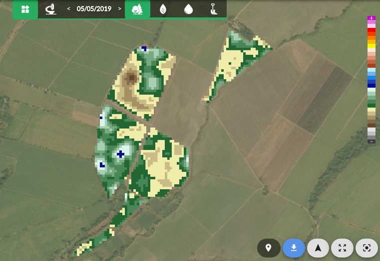
Agroinsider mobile WebApp showing biomass anomalies on sugar cane parcels in Central America, measured by Sentinel 1; Credit: Agroinsider LAC, SA.
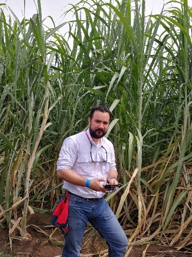
Agroinsider technical staff visiting (scouting) the sugar cane parcels with the Agromap mobile WebApp. Credit: Agroinsider LAC, SA.